| EOStation |
| Schedules |
| MODIS data |
| Custom service |
| Under the hood |
| >Software |
| Image gallery |
| Contact us |
Software Tools
R&D center ScanEx presents several software tools that may help you to work
with MODIS data.
We would like to receive you questions, propositions and
bug reports sent to eostation@scanex.ru.
IMAPP (International MODIS/AIRS Processing Package)
IMAPP (International MODIS / AIRS Processing Package) for Windows (IMAPPW) - a must have for those working with low level MODIS data. This package contains programs that let one to unpack MODIS data stream and then geolocate and calibrate the image. IMAPP has been designed at SSEC,University of Wisconsin-Madison. IMAPP version presented here has been ported to MS Windows by R&D center ScanEx.
 IMAPPW.v15R1.zip
(34MB) IMAPPW.v15R1.zip
(34MB)(released on 2004-01-16) |
IMAPP for Windows ver.1.5R1 installation package
containing all programs and mandatory ancillary files. If you are
upgrading existing software, please, check your settings in the
imapp.ini after running new installation. ! R(elease)1 incorporates patches resolving problems with Terra's NAD state flags. We advise all users to update the IMAPPW to this version. If you have version 1.5 installed and want to reduce download volume you may fetch and replace only main updated file calibrate_exe.zip |
|
IMAPP_LWM.zip
(8MB) |
Land-Water mask files (lwm*) for use with IMAPP. It requires about 900MB to decompress. These files are optional for running IMAPPW. |
|
imappw_um.htm
(45 kB) |
IMAPP for Windows ver.1.5 - user's manual (in English) |
| DEM files | DEM files may be downloaded from SSEC's IMAP site (look for old IMAPP level-1 versions) (files dem30ARC_..._imapp.hdf.Z). |
| utcpole.dat leapsec.dat |
Ancillary files that require systematic updates. Fresh copy may be found in Internet (one of the regularly updated places is: ftp://oceans.gsfc.nasa.gov/COMMON/utcpole.dat or http://oceandata.sci.gsfc.nasa.gov/Ancillary/LUTs/modis/utcpole.dat , ftp://oceans.gsfc.nasa.gov/COMMON/leapsec.dat or http://oceandata.sci.gsfc.nasa.gov/Ancillary/LUTs/modis/leapsec.dat ) |
GBAD
GBAD (Ground Based Attitude Determination) Converter creates ephemeris and attitude files from data packets in the Aqua spacecraft telemetry downlink. Output of the GBAD is requred to perform geolocation of the Aqua data with IMAPP. This package is maintained by GSFC (see. Direct Readout Lab software page). Here you may download binaries for the GBAD convertor compiled to run on MS Windows platform. Note that these binaries are included in the IMAPPW distribution starting with version 1.4.
|
gbadw2.zip
(350kB) |
GBAD for Windows |
IMAPP2DAAC
This tool is intended to resolve one annoying problem with MODIS data product files produced with the IMAPP software. The problem is that format of these files does not strictly follows MODIS product specifications and as a consequence files produced with IMAPP do not identical to those produced at EOSDIS DAACs. imapp2daac tool simply adds some additional information to the IMAPP produced MODx data files. This makes them true HDF-EOS and similar to those produced at EOSDIS.
|
imapp2daac.zip
(350kB) |
IMAPP2DAAC distribution package |
MODIS DB Algorithms
These are software tools to obtain some higher level MODIS
products. DB counterparts of EOSDIS production software use nearly the
same algorithms but are changed (or rewritten) in order to be used in
simplified environment convenient for DB users. Primary distribution
point for these code is at the
Direct Readout Portal.
From here you may download several DB software packages ported and
compiled for the MS Windows platform. You may also try several
accompanying utilities which were developed at ScanEx to deal with
MODIS products.
| Software | Add-on utilities |
|---|---|
| MOD14 - implementation of the MODIS
fire detection algorithm. Produces MOD14 fire mask products taking
MOD21KM and MOD03 as input. [ MOD14w.zip
(214 kB) MOD14 Windows binary] |
mod142shp
- extracts and converts MOD14 fire points into ESRI SHP formatted
vector map for use in GIS |
| IMAPP Level2 Cloud Mask
(MOD35) - a piece of IMAPP Level2 software by
Univ. of Wisconsin's team for calculation of MODIS DB Cloud
Mask. [ cloudmask.zip
(1.7MB) Windows binaries] |
modcmex (246 kB,v.1.4) - MODis Cloud Mask EXtractor. Utility
to extract information from bit-encoded MOD35 arrays in accordance
with user specified rules. It produces common BMP or GIF formatted
pictures. |
| NDVI-EVI code by Rapid Response Project
computes simplified NDVI and EVI fields from a corrected
MODIS reflectance data [ drndvi.zip
(11MB) Windows binaries] |
MODIStools for ENVI
Modistools - add-in library for ENVI for work with the first levels MODIS data (i.e. MOD01-MOD02). This module contains functions that let to do following operations:
- correct loaded image bands for bow-tie distortions,
- create standard ENVI GCP file for image-to-map warping,
- load radiance and brightness temperature values into available bands
This library is available for free and may be downloaded from this site. See included text file for installation and usage notes.
|
modistools_envi.v10.zip
(15kB) |
MODISTools ENVI add-on |
HDFBROWSE
HDFBROWSE.exe is a small command line utility that can be used to dump a one band slice of any HDF's SDS into a common image format (Windows BMP and TIFF). This tool was created having MODIS (and generally EOS-produced data, e.g. ASTER) data handling in mind. This is why it has several MODIS - specific features:
- processing of 16bit pixel values (store to 16bit TIFF and equalized conversion to 8bit BMP)
- geometric correction for bow-tie distortions
- flexible specification of a required SDS name, dimension and band index. These cover most cases of MODIS and ASTER L1A and L1B files. The user's reference contains exhaustive information how to specify parameters for low level MODIS products.
Short reference is included in the provided binary package. Extended version of the HDFBROWSE, which supports RGB synthesis and exports to JPEG and ECW, is available by request.
|
hdfbrowse.zip
(260kB) |
HDFBROWSE binaries and manual |
Commercial software from ScanEx
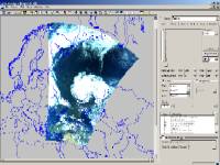
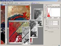
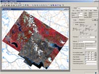
ScanMagic® - generic purpose program for visualizing, analyzing and processing remote sensing data. Among a lot of supported formats and data types it supports generic HDF files and offers extended possibilities to work with MODIS products. Detailed description and free demo version may be found at ScanEx's site
 |
 |
 |